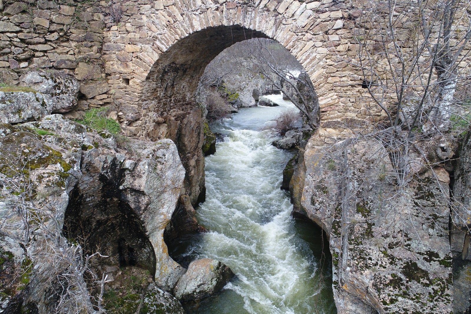
Historical bridges
From the confluence of roads and rivers arises the need to link both banks: this is where the road transforms and the bridge emerges, as a crossroads of roads and a meeting place for towns and people.
Bridges always arise in response to specific needs, as well as environmental conditions. For this reason, they are testimony to other times and the passing of the years, constituting a historical legacy of great interest and a wide repertoire of materials and solutions, both constructive and structural.
The Community of Madrid, through the General Directorate of Cultural Heritage, works on the recovery, conservation and restoration of this type of heritage. For this, it has designed the Action Plan on Historic Bridges, capable of inventorying and cataloging these elements, analyzing their state of preservation and recovered for use. One of the priorities is to make known the cultural values of the historical bridges, in order to encourage their public enjoyment, as well as to integrate them in tourist routes of heritage and environmental, understanding the bridge as "crossroads" and as an integrated element in the landscape.
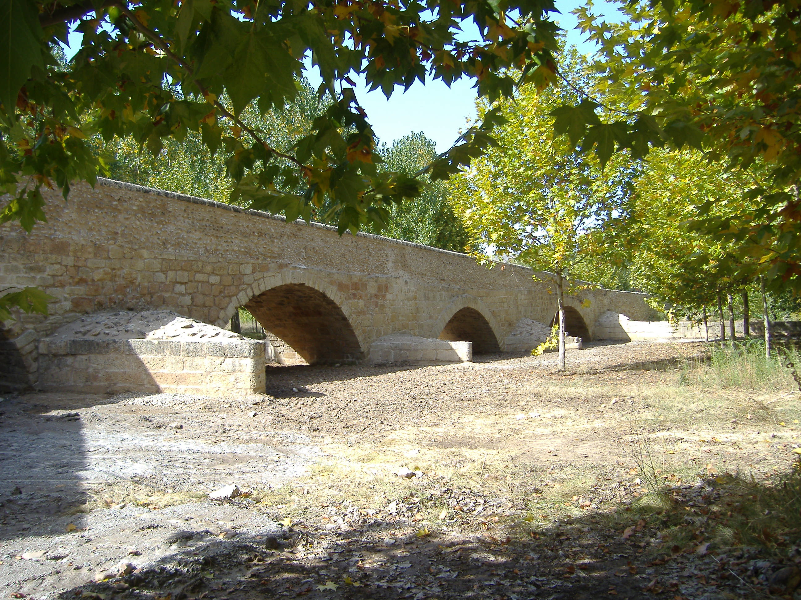
On the outskirts of the town, at the end of the road that starts at the rear roundabout of La Cartuja and leads to a chopera, stands this medieval bridge, which has not been used since the course of the Jarama River has been displaced over the years. Of medieval invoice with later transformations, that as many had a Roman origin this bridge was located in the "route of the Jarama" on the old way of France.
The length of the bridge reaches 150 m. It is made with limestone ashlars from Tamajón, masonry and granite from Colmenar, the layout of which is breaking, offering a variable width of the deck, which is reflected in its mouths, regulating the farthest away, between parallel parapets; with a pronounced widening the closest. Another peculiarity of this bridge is that it is made up of a large central arch and four smaller ones that develop only towards one of the slopes, possibly due to the topography of the land next to the old course of the Jarama River.
The bridge underwent a comprehensive restoration process in 2008. For this, a preliminary study of its formal and constructive characteristics, as well as pathologies and deficiencies, was carried out.
In the first place, archaeological tastings were carried out in order to establish the start level of piles, vaults and cuttings and analyze the stratigraphy of sediments. In addition, a reading of walls was made, allowing, for all this, to obtain information and identify the different historical, constructive and use stages of the bridge.
The main action was carried out on the platform, which was waterproofed to prevent the transmission of moisture to the vaults, for which the pavement was raised, a 15 cm lime, sand and gravel concrete screed was created, with mass reinforcement made of concrete based on polypropylene fibers. Later, the pavement was replaced.
The most delicate works were the dismantling of the existing paving over bays two, three and four, after numbering, planimetry and photography. Some slabs were restored and sewn to be reused. The rest was paved with cobblestone stones, leaving paths perimeter rows of stone slabs of Campaspero.
The water collection system was designed in such a way that it was the bridge deck itself that acted as a large gutter that led the water to the outside. The system was respected, but collecting the water at the beginning (entrance area of the bridge) and at the end of the deck. For this, some pieces of limestone were placed, as a grid that collects the water at those points. Under these pieces a gutter was arranged that leads the water to both sides of the bridge. A draining layer of gravel was placed at the meeting of the pipeline and the ground.
Rooted vegetation was cleaned on the parapets, vertical walls and cutwaters, the stone was chopped and rejoined and the existing cavities were filled, sealing the cracks and repairing the joints with lime mortar. The upper face of the parapets was waterproofed with waterproofing mortars.
Finally, the deck ramp was extended to join it with the ground level with a reinforced concrete supplement on a pebble roof and delimited with cast iron bollards to prevent the passage of vehicles, and the access road was prepared.
The Mocha Bridge, over the Cofio River, is integrated into a natural mountain environment protected by the Forest and Nature Protection Law of the Community of Madrid. Before the intervention promoted by the General Directorate of Cultural Heritage, it had a significant deterioration, with cracks in the cutwaters and danger of collapse, loss of the parapet along its entire length -except above the main arch-, as well as vegetation between its ashlars.
The bridge, measuring 55 meters in length, is supported by four semicircular vaults and two openings in the starts. On the upstream side there are three triangular planks with pyramidal caps.
Of Roman tradition, it reflects different construction periods, however historical studies point to its rise or reconstruction in medieval times as an infrastructure to facilitate repopulation after the Reconquest; Likewise, its connection with the construction of the El Escorial Monastery in the XNUMXth century is considered, being used to facilitate the transfer of wood and granite from the area.
The General Directorate carried out, prior to the intervention, a topographic survey, as well as a study to characterize the bridge materials. This study, commissioned by the Institute of Economic Geology (CSIC-UCM), allowed us to know the materials used in different periods, together with the location of stone marks. Aerial photographs were also taken.
The intervention, of conservation and integral restoration, consisted in the cleaning and clearing of the immediate terrain, under the supervision of the Department of the Environment, as well as the withdrawal of the paintings made on the ashlars and the stonework and the application of a biocide for the elimination of mosses and lichens.
Mortars in poor condition were also eliminated and the inadequate parts were removed for subsequent assembly continuing the existing factory. The lost pieces were replaced with granite from the area, extracted by traditional techniques. Finally, a punctual recess was made in the cavities and the parapet was rebuilt with granite pieces of similar volume to the existing ones, using those located in the immediate surroundings. Finally, the original levels on the board were recovered. Likewise, information posters about the performance were available.

The Bridge is located on the border of the municipal term of Madrid (Monte de El Pardo) and the municipalities of Tres Cantos and Colmenar Viejo, on the Manzanares River, embedded in a deep gorge at the foot of Cerro de la Marmota, from which it receives your name. It is located within the Regional Park of the Cuenca Alta del Manzanares, an area protected by its environmental and natural values.
It was ordered to be built by Fernando VI as part of the improvements that the monarch made in Monte del Pardo in order to delimit the royal hunting ground. The works, carried out between 1756 and 1758, were carried out giving continuity to the enclosure stone walls of the preserve, reaching about 99 km. Together, other infrastructures were built in the area, such as the San Fernando bridge, also over the Manzanares river, the Puerta de Hierro and the small bridges that span the Valdeculebras, de las Viudas, Tejada and Trofa streams, all of them tributaries of the Manzanares.
It is a bridge with a round vault of 12 meters of light, a width of 6 meters of deck and a length that reaches 45 meters. It was ordered to be built by Felipe V as part of the improvements that the monarch made in Monte del Pardo in order to delimit the royal hunting ground. The works, undertaken between 1756 and 1758, were carried out giving continuity to the stone enclosure walls of the preserve, reaching about 99 km. Together, other infrastructures were built in the area, such as the San Fernando Bridge, also over the Manzanares River, the Puerta de Hierro and the small bridges that span the Valdeculebras, Las Viudas, Tejada and Trofa streams, all of them tributaries of the Manzanares.
Its name probably comes from the small mountain located on the river. The bridge has an eye, formed by a vault with a semi-circular arc resting on the rock itself, and is executed with an excellent masonry factory.
The General Directorate intervened in 2012 on the bridge since, although its structure was in a good state of conservation, the continuous accumulation of land caused by erosion and sedimentation on the board of the material coming from the upper slopes of the road, had originated a notable overweight and in some points the bridge began to give way. For this reason, the roads were prepared on both sides and the removal of the accumulated earth on the board, as well as the restoration of this and the parapets.

The Bridge of La Mata, erected on the Miraflores river, seems to have its origin in the Middle Ages, within a secondary road that communicated Madrid with the Lozoya valley; in the 18th century it was rebuilt in stone, this work can be dated between 1710 and 1712.
It is a bridge with a linear character, with only one eye, formed by a vault with a half-point arch. The dimension between starts of the vault does not exceed five meters.
The General Directorate of Cultural Heritage intervened on the bridge at 2013, given that it presented conservation problems that posed a risk to its stability. Likewise, an intervention was necessary that allowed the investigation and valorisation of the aforementioned cultural property and its relationship with the source of La Mariñeta, downstream.
The existence of a new bridge, downstream, had caused the loss of use of the La Mata Bridge, as well as the abandonment of its conservation. The vegetation was also one of the main causes of its degradation, having also produced the loss of different elements.
The restoration project included the following tasks:
- Cleaning of the stone factory, filling of cavities, location and stockpiling of the parapet pieces scattered around the base of the bridge. Interventions on the board and flooring.
- Restoration of the parapets.
- Cleaning and improvement of the bridge and fountain environment.
- Elimination of added elements such as existing metal beams.
- Placing posters to disseminate the actions carried out.

The Piedra or La Mina bridge is located on the Arroyo del Valle, near the Regional Park of the Sierra de Guadarrama and the Lozoya River Basin and its reservoirs.
Built at the beginning of the 19th century, it has four eyes formed by vaults with a half-point arch that defines, on the outside, large stone arches supported by a masonry plinth flanked by circular section cutters with a conical cap, and inside, the factory vaulted brick.
The parapets, which are made up of large pieces carved by stonemason, stand on the impost that defines the level of the board and whose ends divide triangular retaining walls.
The General Directorate of Cultural Heritage acted in 2013 on the bridge, proceeding to its complete restoration: cleaning and conservation of the original walls, recovery of the missing parts of the parapet, placement of a new pavement on the board and adequacy of the banks of the river .
This last action included, in turn, the movement of land to discover the parts of the bridge buried by the sedimentation processes, as well as the clearing and cleaning of the channel and the margins of the valley stream in an area from 4 to 5 meters to from the bridge.
This phase did not contemplate, however, action in the immediate surroundings, so, once the intervention was completed and the bridge had been recovered in its entirety, the need to carry out the appropriate earthworks in 2014 to adapt the immediate surroundings was raised. which then reached an average of one meter in height, practically covering the cutwaters and the lateral retaining walls, in order to prevent the progressive burial of the element from occurring again.
The bridge had an excess of stubble and trash in the vicinity and on the access road; large amount of sediments, especially in the "upstream" area; and a sinkhole in the part of the "downstream" channel, product of erosion.
Consequently, the actions that were developed as part of the intervention carried out in 2014 were the following:
- Clearing and cleaning of river banks.
- Earthworks, filling and compaction of road surfaces.
- Construction of a breakwater of large granite pieces.
- Consolidation of slopes and channeling of the waters of the board.
- Plantations for fixing land on embankment walls.
- Restoration and recovery in its entirety of ramp built with stone slabs downstream.
- Construction of walkways.
- Placing posters to disseminate the actions taken.

The Puente de Piedra crosses the Valdelargo stream, in the municipality of Boadilla, being located within a grove called El Bosquete.
It is a bridge with a single eye formed by a carpanel arch with granite voussoirs, built from carefully carved ashlars. It is equipped with a stone parapet, fully preserved.
Its origins date back to the 18th century. The lands near the Palace of Infante Don Luis had many ornamental elements (bridges, fountains, grottos, ponds), becoming the streams, as well as incentives for the playful activities of the inhabitants of the palace, in fundamental elements for the irrigation of the crops and fruit trees. The vegas of the channels was the most attractive areas, and in this context the poplar grove, El Bosquete.
It seems that the bridge could be a work of the architect Ventura Rodríguez for Infante Don Luis, erected after the year 1765, date of completion of the construction of the palace. On the bridge, the road from Boadilla to Segovia and the Camino Real from Madrid to Segovia passed by the sale of San Antón and Galapagar.
In 2013, the General Directorate draws up the intervention report on the bridge, the work being carried out by the City Council, consisting of the consolidation, restoration and enhancement of the element. The following actions are carried out:
- Intervention on the board: cleaning of loose soil, consolidation of the support, restoration of the granite curb.
- Parapets: cleaning and restoration of cracks, vegetation cleaning, protection application.
- Eye and vault: cleaning and treatment.
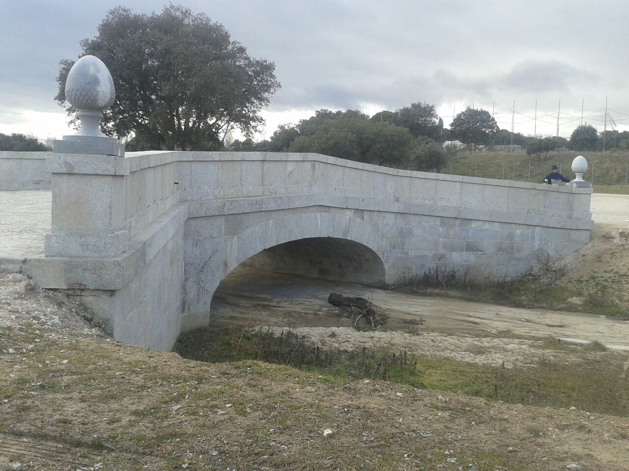
The Salustiano Bridge is located west of the urban center of Miraflores de la Sierra, on the Miraflores River. Of probably medieval origin, it could have been a wooden bridge related to the presence of a mill in its surroundings. It had to be rebuilt in stone in the XNUMXth century.
It is related to the branch that linked Miraflores de la Sierra with the historic road that connected Soto del Real with Rascafría through the port of La Morcuera. Across the Bridge of Salustiano it was acceded to several secondary roads or paths that connected with this historical way. It was also related to the Cordel de la Morcuera and two important resting places located in its surroundings.
It is a bridge with a linear character, with only one eye, formed by a vault with an arc of less than half a point. The dimension between starts of the vault does not exceed five meters
On the right bank of the river bed, to the southeast of the bridge, are the remains of two buildings in ruins with a border wall that also includes the land surrounding them. It is two mills in ruins of rectangular plant. Also, there are three sources, in the immediate environment, all with spout and battery.
The General Directorate of Cultural Heritage intervened in 2013 on the bridge due to its state of deterioration. The factories and the vault were highly affected by the presence of strongly rooted creepers, with vegetation constituting one of the main causes of degradation, together with the action of meteorological agents, as well as the poor functionality and lack of use of the bridge.
There were leaks at the start of the vault and the soffit was full of roots and vine shoots, there had been the loss of mortars between ashlars and masonry, as well as erosion at the start of the factories and a significant accumulation of sand and sediment , especially in the South zone. Finally, there were significant water leaks and the loss of a good part of the elements of the parapets had been verified.
The action had as a priority the restoration and consolidation of the element, avoiding the advance of its deterioration, as well as the development of the opportune works to correct the injuries that it presented:
- Cleaning of the environment, withdrawal of runoff land.
- Actions on the quarry factories: location and stockpiling of the parapet pieces scattered around the base of the bridge; replacement, revision and reinforcement of parts; cleaning of the stone factory and filling of cavities, the vegetation of the walls, the stone and the vaults; cleaning of mortars, etcetera.
- Performance on the platform: restoration of the board and flooring, installation of lost pieces.
- Parapets: cleaning and replacement of lost or damaged parts.
- Actions in the environment: diffusion posters, improvement of access to the bridge.

The Puente del Grajal, located on the Manzanares River, in the municipality of Colmenar Viejo, is located within the Regional Park of the Cuenca Alta del Manzanares. In parallel to it is the Puente Nuevo del Grajal, through which the M-618 road runs between Colmenar Viejo and Hoyo de Manzanares. It is a bridge whose origins could be Roman, probably having belonged to a transversal route to the passage of the Itinerary of Antonino, which crosses the Puerto de la Fuenfría, joining Galapagar with Colmenar Viejo.
The bridge, with a single eye, with a semicircular arch and a split board with two slopes, sits on the living rock of the riverbed. It is executed with granite ashlar factory in the intrados of the arch and remarking this by means of voussoirs, being the rest of the construction of granite masonry. The parapets maintain the inclination of the boards.
The General Directorate of Cultural Heritage undertook the complete restoration of the bridge in 2013. The works consisted of:
- Cleaning the environment
- Elimination of vegetation in the vicinity of the bridge, as well as land accumulated over time on the board.
- Conditioning of the slope of the road to prevent the re-accumulation of lands.
- Replacement of the lost flooring.
- Placement and consolidation of parapets.
- Carrying out archaeological tastings on the deck and mouth of the bridge.
The Calicanto Bridge, located on the Arroyo de los Robles in a place called Tobelina, was built in 1579 by agreement of the Council of Buitrago, which estimated the interest of this ford as a way to Valladolid, Segovia and Pedraza, being also an obligatory step to reach the hermitage of La Trinidad.
Its name comes from the contrast of its masonry factory with that of a previous wooden bridge, which would replace the current stone.
It is a one-span bridge, with an approximate length of 8 meters and 2,5 meters of width of passage. Its structure is composed of a semicircular arch - or small vault built with roughly squared gray granite voussoirs resting on natural rock; The rest of the bridge, retaining walls and parapets, is formed by stone masonry of origin, sizes and irregular shapes.
The Calicanto bridge presented damages of considerable size that compromised its survival, consisting mainly of the progressive loss of components of its factories.
Faced with this situation, the Directorate General of Cultural Heritage decided to intervene in the element in 2013, focusing on those aspects that most compromised the integrity of the bridge:
- Falling voussoir in the intrados of the arch.
- Loss of filling in one of the kidneys of the arch.
- Crumbling of the parapet in two points of the bridge.
In addition, after the archaeological excavation, the original cobblestone pavement was discovered, which was completed, as well as a historic bridge drain that has recovered its function after the works.

The fullan and the bridge to which it gives name are located within one of the historical routes that crossed the municipal term of Old Colmenar and that united Alcalá de Henares with Segovia. Of medieval origin, the bridge has been closely linked to the Cañada Real Segoviana, livestock route that links the current provinces of Burgos and Badajoz, as well as the Camino de Santiago that was born in Madrid.
From the sixteenth century it began to be known as the "New" Bridge or "New" Bridge, perhaps due to some reconstruction made as a result of a flood. Its current name dates back to the mid-nineteenth century and is due to the existence of an old batán upstream, a building that housed the hydraulic machinery to treat tissues to provide them with the desired body. It worked by the force of a current of water that produced the necessary movement in the machines to transform open fabrics into more dense ones.
It is a simple construction of rectangular plant and granite masonry factory, of which the remains of three of its four perimeter walls are conserved, two of which keep in their lower part the vaulted openings through which the entrance was produced and exit from the water that moved the machinery of the fulling mill.
For its part, the bridge, built directly on the granite rock, was raised by saving a gorge from the Manzanares River. It is made of local granite stone and has a single semicircular arch. In the late nineteenth or early twentieth century the parapets of the bridge were removed to give it a wider width and facilitate vehicular traffic of larger vehicles.
In order to stop its process of deterioration and correct the pathologies it presented, in 2014 the General Directorate of Cultural Heritage promoted a set of actions aimed at consolidating the batán and restoring the bridge to which it gives its name. These works consisted of:
- Fuller: consolidation of the wall elements, revealing even the water basin that regulated and supplied the batán, and development of an archaeological intervention aimed at the study and recovery of the hydraulic system, as well as exhaustive cleaning, both of the environment and the interior of the fulcrum .
-
Bridge: the works contemplated the cleaning of the surroundings and the removal of land, as well as the elimination of the rooted vegetation in the walls and in the intrados of the vault. One of the most important aspects was the reconstruction of the parapets, of which the bridge lacked. On the platform, the earth and sand that covered the deck were removed and several archaeological surveys were carried out to establish the original levels, which made it possible to find the historic pavement with part of the original paving stone preserved.
Finally, in collaboration with the technicians of the Ministry of Environment of the Community of Madrid and the Hydrographic Confederation of the Tagus, the appropriate actions were taken to restore the natural terrain and leave the landscape free of any damage that the execution of the restoration work could have caused.
Likewise, posters have been made available to disseminate the actions carried out and the operation of the batán.
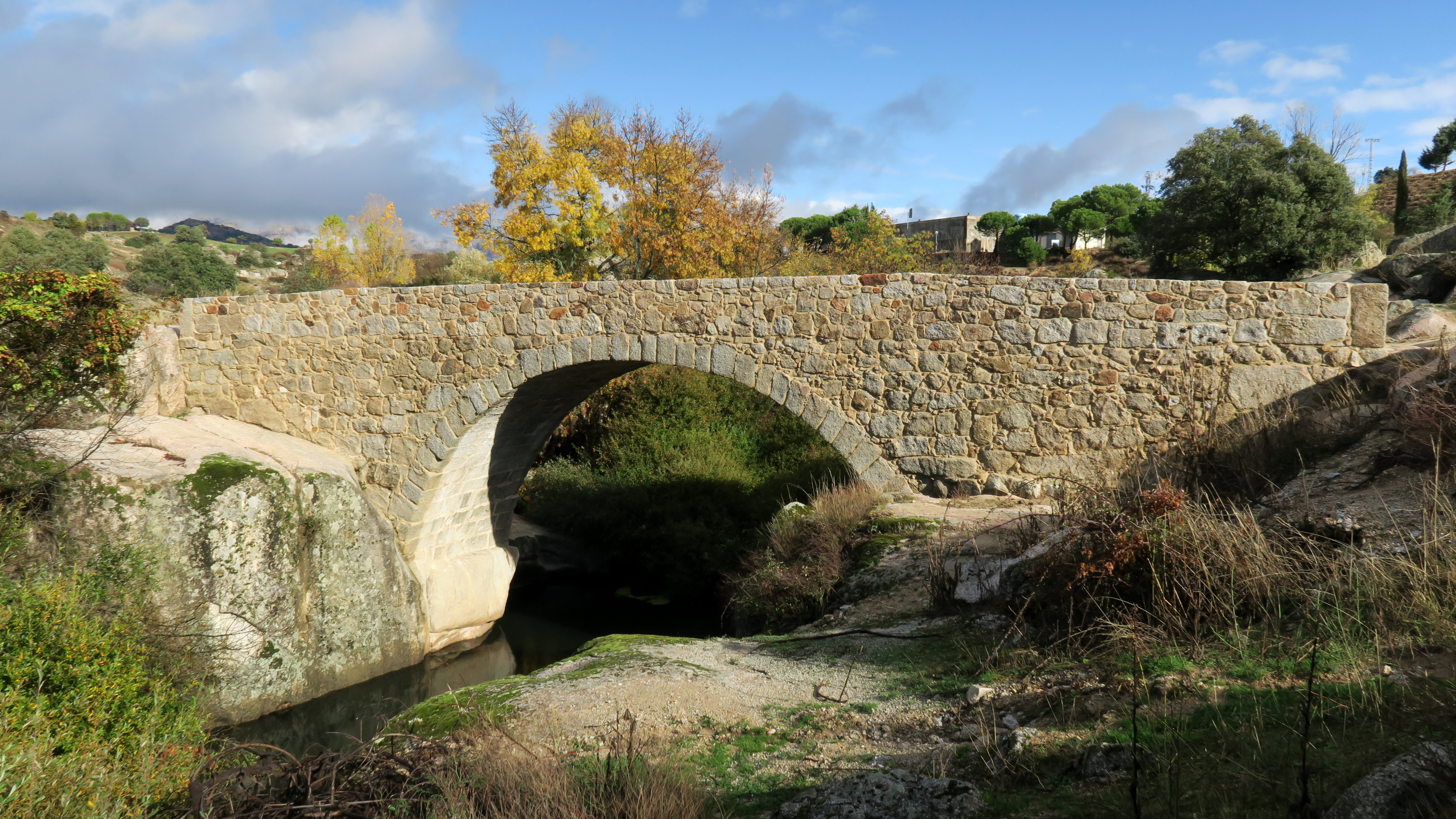
The bridge of the Cure is located in the municipality of Las Navas de Buitrago, on the road that connects this town with Cinco Villas, on the stream of La Nava. Its origin, as well as its name, is due to the path that the parish priest had to go to go to say mass in the neighboring town of Cincovillas. This route crosses the stream of La Nava, whose channel in winter and spring made difficult the passage, reason why the parishioners decided to build a bridge that facilitated this task.
It is a bridge of reduced dimensions erected on the stream of La Nava and oriented in the direction of the road, North-South. It consists of a single vain with a semicircular vault built with granite masonry; the eardrums are supported on the vault, made of stone masonry, and above them there is a horizontal impost line, also made of granite, on which rest the large pieces that make up the parapets. There are four granite-free pieces, carved with a truncated cone shape and located at the ends of the parapets.
Of the pavement, which had it judging by the start of the parapets and the height of the spillway or water outlet, nothing is preserved at present.
The General Directorate of Cultural Heritage intervened in 2014 at the Puente del Cura, undertaking the integral restoration of it. The works supposed:
- The consolidation of the lateral retaining walls, having recovered the lost stone material and carried out the filling of joints in the points that have required it. The replacement of the granite slabs that top these elements in their upper part.
- The reinforcement of the support of the north margin of the bridge vault.
- The recovery of original levels on the board and in the immediate environment.
- The paving and treatment of factories by replacement of lost pieces.
- The cleaning and removal of vegetation rooted in the bridge factory.
- The collection of the material found in the river bed and its surroundings. The original material of the bridge was reused in the intervention.
- Disposition of informative signage on the actions carried out.
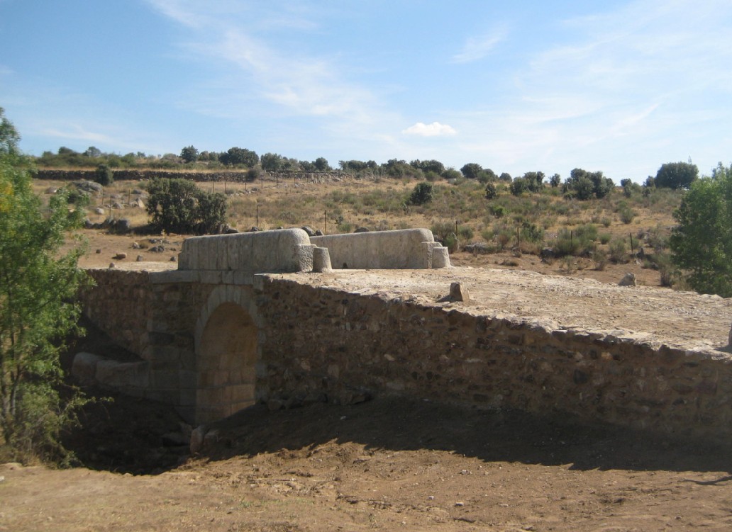
The Pasadero bridge is located on the Perales river, one of the main tributaries of the Alberche, downstream of the Cerro Alarcón dam and at the end of the livestock road called Colada del Camino de Quijorna.
The theory of greater weight on its antiquity and origin is the one that suggests that it could be one of the five bridges built during the Islamic domination in the center of the Peninsula, on the road that linked Talamanca de Jarama with the Tiétar Valley. The objective of these bridges was to unite the different citadels and observation watchtowers erected by the Muslims.
The bridge of the Passenger, of reduced dimensions, rises on a small embedding of the Perales River and is cemented directly on the rock. The material used in its construction was the granite of the place. The only preserved element is its semicircular barrel vault on which the eardrums rest.
In 2010 the General Directorate of Cultural Heritage carried out a set of actions in which the factories were consolidated, one of the lateral walls of land containment was reconstructed and the accessibility of the bridge was improved.
In 2014, a project was once again launched that aimed at the reconstruction of the parapets, lost in their entirety, the consolidation of the lateral abutments and the extension in height of the retaining wall reconstructed in the intervention executed in 2010, all with the purpose of guaranteeing the safety of the pedestrians and of returning to the bridge its original physical configuration. Both for the consolidation of the retaining walls and for the reconstruction of the parapets, original pieces dispersed in the immediate environment were used.
Likewise, the intrados of the vault were intervened to eliminate inappropriate dampness and grouting or that were in poor condition. Various cleaning treatments were carried out by manual means, after which the cracks were re-examined and the cavities were sealed with injections of lime mortar.
As the deck of the bridge had disappeared and passed directly on the pieces of the vault factory for its backyard, lime mortar was injected into the cavities between blocks, in order to prevent water leaks that could produce major erosions.
Lastly, informative posters about the action in the environment were set up.

The Malpartida bridge is located on the Perales River, on the old road that goes from Alcorcón to San Martín de Valdeiglesias.
Its construction finished in 1894. It is a bridge with metal structure on stirrups of mixed factory, which allows to save a length of 24,75 m. The structural system is constituted by two large triangulated trusses articulated in the supports, whose upper bars are composed of segments of box beams with an inverted "U" shape.
Taking into account the state of generalized deterioration of the bridge, the General Directorate of Cultural Heritage has developed an intervention of conservation and integral restoration between 2014 and 2015, consisting of two phases of action.
The disuse of the section of highway to which the bridge served caused its sporadic use by pedestrians and in an extraordinary way by vehicles.
The metallic structure presented notable pathologies and deficiencies, due mostly to the lack of maintenance and the action of natural agents. More concretely, the board showed discontinuities in its paving and an inappropriate re-filling of the filling. The support constituted by the metallic vaults lacked an adequate system of evacuation of the rainwater, reason why this one was dammed in the interior of the filling propitiating the generalized oxidation of the metallic components, and the lateral railings -not original-, they did not fulfill fully its protective function.
Consequently, the General Directorate ordered an intervention, aimed on the one hand at repairing damaged components and improving their functional capacity, and on the other, at revaluing their cultural meanings. In a first phase, work was done on the deck and the railing of the bridge, in order to guarantee the conservation of the property as well as to provide it with the necessary security measures for its public enjoyment.
The actions carried out were the following:
- Analysis and characterization tests for the purpose of defining the interventions.
- Clearing and cleaning the board. Demolition of protection elements and emptying of said element.
- Repair of damaged metal components of the board
- Construction of new board and handrail.
- Repair of factory abutments, with the addition of new grouting and plastering, and treatment of upper plateaus.
In a second phase, the damage caused by the action of natural agents, as well as the lack of maintenance, which affected the structure of the bridge, has been solved. In essence, it was about: the invasion of weeds in the perimeter components, the general loss of protection provided by the finishes, the consequent oxidation of the structure and the deterioration of the factories.
In this sense, we have proceeded to the timely repair of the damaged parts, the cleaning of the surfaces, the removal of the weeds and the creation of a lookout and path.

The Alcanzorla bridge is located in the municipality of Galapagar, a town located in the northwest area of the Community of Madrid, in a place of high environmental value, protected by its inclusion in the Regional Park of the Middle Course of the Guadarrama River.
The bridge responds to a medieval invoice possibly of Islamic origin (IX-X) and was erected to serve the military road that linked the watchtowers or beacons that protected the Muslims from the incursions of northern Christians.
It presents unequivocally Andalusian proportions, which incorporate a single semicircular arch, of the shape known as "donkey's back", with a board width of measurements commonly used in the Hispano-Muslim bridges of the emiral and caliphal epochs, which differ from the bridges of Roman invoice and of the Christians. The construction was made of granite stone embedded in the structure by masonry, except for the voussoirs of the vault that are formed by regular ashlars.
The state of conservation of the bridge was precarious, with the total loss of its parapets and great part of the eardrums. The starts on both sides of the river were also deteriorated, compromising the stability of the vault.
Considering the situation of the property, the General Directorate of Cultural Heritage undertook in 2015 the development of a project for its restoration, beginning with the cleaning and clearing of the environment as well as with the realization of two archaeological tastings. Subsequently, we proceeded to a reading of the walls and their subsequent cleaning, eliminating in turn the biological colonization. Finally, it was consolidated and retacado, also treating cavities and mismatches and partially recovering its startups.
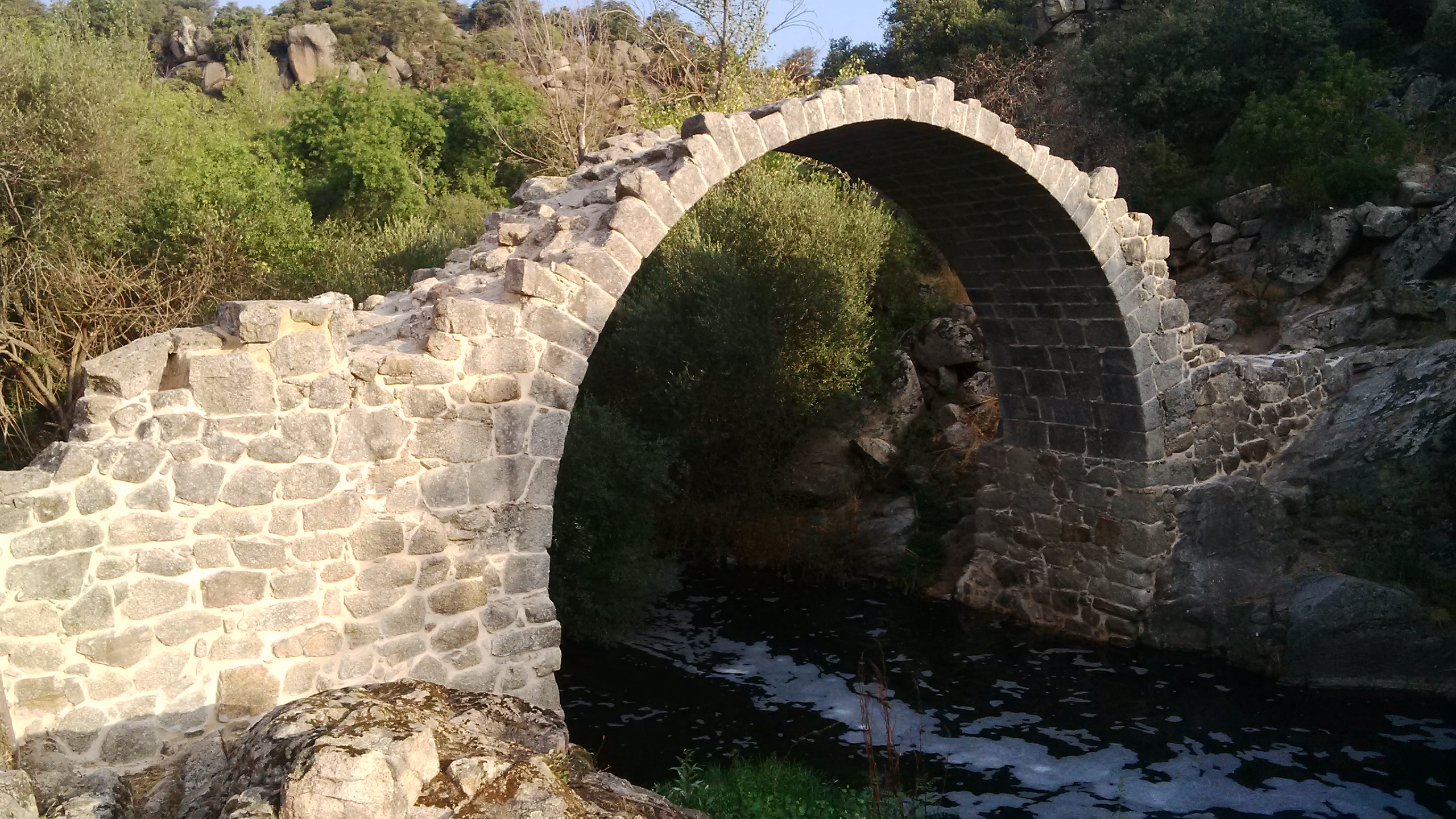
Located on the Paseo del Monasterio Antiguo, crossing over the Guadarrama River, the so-called bridge is located next to Monesterio, in the municipal districts of El Escorial and San Lorenzo de El Escorial. This work is included in Camino Real, currently called "Colada del Camino de Villalba", which connected the monastery of San Lorenzo with the historic farm of El Campillo and the urban settlement of Monesterio.
The current stone bridge dates from the first half of the 17th century and follows the traces of the crown's architect Juan Gómez de Mora. The bridge would respond to a proposal that the prior of the monastery of San Lorenzo del Escorial referred to King Felipe III to rebuild three existing wooden bridges between the road of El Campillo and Monesterio.
The bridge responds to a four-eye scheme, whose length is 52 m. and its width of 4.60 m. It has three intermediate piers, with cutwaters located upstream to reduce the pressure of the water current on said supports. On the piles there are four large arches that serve as a structure for the upper deck, whose sides are protected by separate parapets. Next to the eastern access, on the south side, are the remains of the entrance door. The high quality of the materials (very well squared granite chairs) and the careful execution of the construction systems stand out.
In view of the state of abandonment of the element, the General Directorate of Cultural Heritage proceeded to make an action on this historic bridge.
When carrying out the archaeological investigations associated with the intervention, it was discovered that the bridge had a considerably greater span than the supposed one, as an unknown eye was buried to date, as well as the authentic gauge of the bridge deck, which is endowed with a remarkable curvature, which had been buried by successive fillings made in order to rectify the slope of the original road.
After proceeding to the cleaning and clearing of the undergrowth that invaded the element, restoration work began, affecting the entire bridge. We proceeded to the treatment of the access jambs providing them with an adequate support, and recovering the north jamb volumetrically.
Thanks to the amount of original factory recovered from the riverbed, it was possible to recover a large part of the original paving stone and the pieces of the parapets were placed following the trace marked by the ashlars of the imposts that finish off the sides of the deck. Finally, the factories were cleaned and sanitized, providing them with a protective layer that reduces the absorption of water from them.
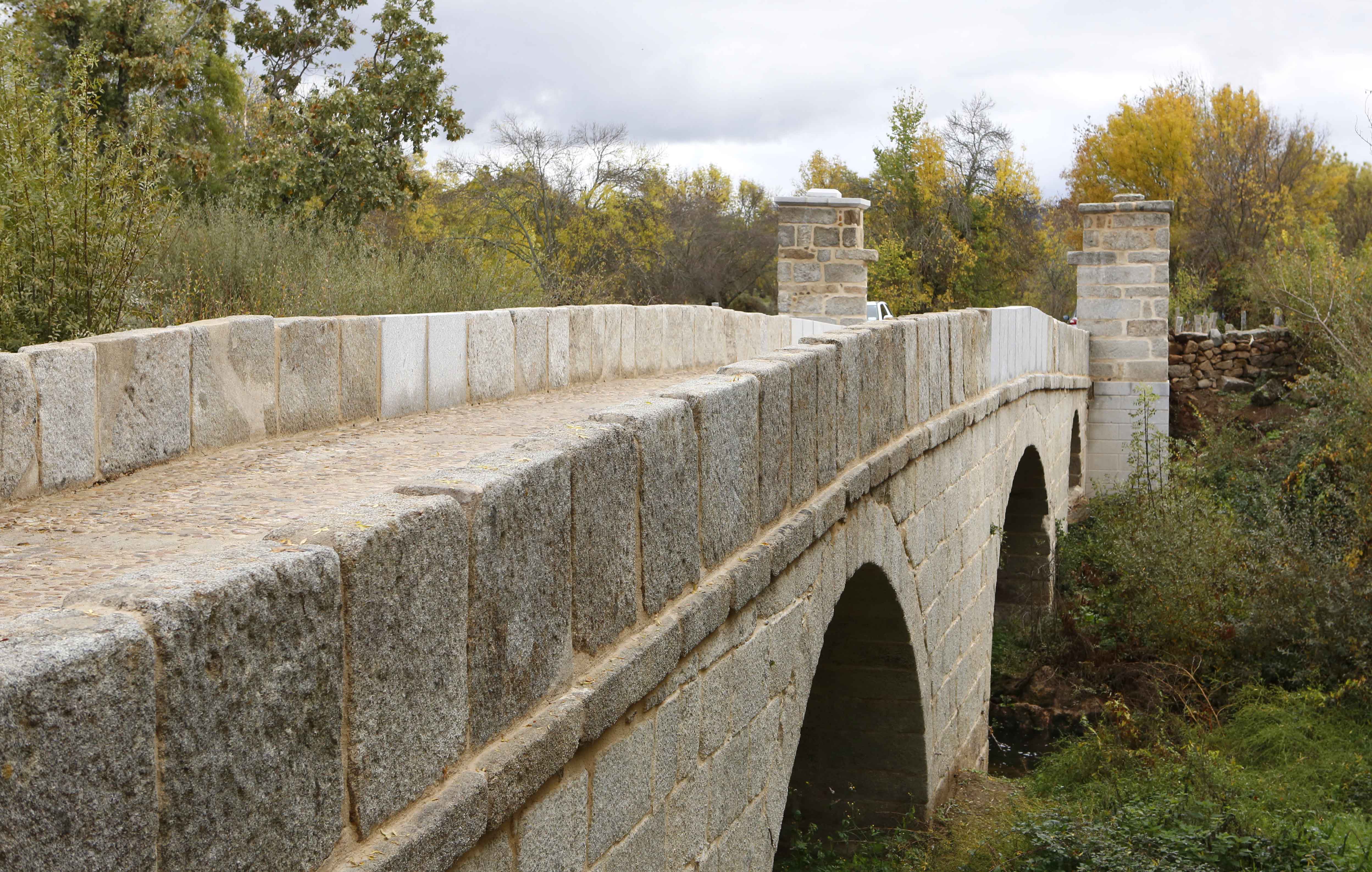
The Puente del Congosto is located on the river of the same name, located in the municipality of Lozoya, in the Alto del Lozoya Valley, in the Sierra Norte de Madrid, 2 km from Rascafría. The area is part of the Sierra de Guadarrama National Park.
The bridge, as well as the flour mill located upstream, on the left bank of the Lozoya River, are linked to the historic road that connected the nuclei of the municipalities of the Lozoya Valley, before the Monastery of El Paular was built and that other alternative routes that would connect the valleys of the Miraflores River with the Monastery itself were opened. Currently, surveys and archaeological studies are carried out, both of the construction of the mill and its surroundings, in order to discover the channels that led the water from the river to the mill and from this back to the river.
The bridge is of medieval origin, with a single eye and half-point vault. It is laid directly on the rock and built in unworked stone and with masonry.
The choice of the place for its construction responds to the fact that it is the place where the distance between the banks of the Lozoya River is smaller. Its great height with respect to the flow constituted a guarantee of permanence and stability against the great fluctuations and strong avenues that the river experiences.
Before the restoration, the bridge was semi-hidden as a result of the thick vegetation upstream. The most serious problems were those related to lack of maintenance. As a result, he had lost the flooring of the central part and different materials of the structure, as is the case with the original parapets.
Rolling marks were also preserved in different locations, understood as historical vestiges, so the intervention has gone through maintaining and enhancing their vision.
The restoration of the Puente del Congosto comprises two phases. At present, the General Directorate of Cultural Heritage of the Community of Madrid has completed the first of these, consisting of the consolidation and restoration of the most deteriorated elements. During the intervention, access to water has been cut off and the appropriate means have been enabled to prevent future leaks. Likewise, an impermeable layer with lime mortar has been created, which in turn has allowed to recreate the lost flooring.
Also in this first phase, part of the large floor was raised, which allowed to know, document and recover the original levels. In this sense, the archaeological study has allowed us to limit the construction stages of the bridge, know, document and recover the original levels and set the guidelines to follow.
During the restoration the same techniques and materials were used as the original ones. The unstable elements have been consolidated and the lost elements have been reconstructed, following the patterns obtained as a result of the archaeological surveys carried out.
As a result of the action, it can be said that the stability of the bridge has been solved, the leaks and the deterioration suffered during centuries have been stopped.
The stonework and the adaptation of the immediate environment will be carried out in the second phase.
